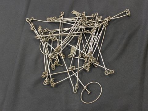
Charles Mullan, one of the earliest settlers of Waterloo, Iowa, used this surveyor's chain to map out the Waterloo area. Chains like this one measured 66 feet long and were made up of 100 different links. Surveyors used these chains to measure the distance between two different points and map out different parcels of land. Content can be used with the following standards: SS-US 9-12.23 Iowans Influence US History and SS-Geo. 9-12.24 Iowans Influence Iowa Environment in a lesson on early settlers and their techniques of surveying new land. For any use other than instructional resources, please check with the organization that owns this item regarding copyright restrictions.
2018.038.006 [Chain, Surveyor's]
Legal Status
Ownership of this resource is held by the Grout Museum District and has been provided here for educational purposes only, specifically for use in the Iowa Museum Association's "Teaching Iowa History" project. It may not be downloaded, reproduced or distributed in any format without written permission from the Rights Holder. For information on U.S. and International copyright laws, consult an attorney.

