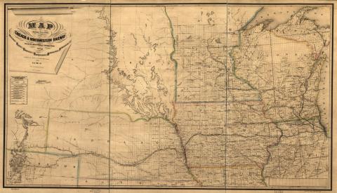
Map of the midwestern states showing relief by hachures, drainage, cities and towns, township and county boundaries, and the completed, proposed, and under-construction railroads. Map also shows the location of the Chicago & Northwestern Railway with its branches & connections through Illinois, Iowa, Nebraska, Wisconsin, Minnesota, Michigan. Content can be used with the following standards: SS-Geo. 9-12.24 Iowans Influence Iowa Environment and 4th grade SS 4.25 Technological Changes in a lesson on maps created for railway use. For any use other than instructional resources, please check with the organization that owns this item regarding copyright restrictions.
2018.056.003 [Map]
Legal Status
Ownership of this resource is held by the Library of Congress and has been provided here for educational purposes only, specifically for use in the Iowa Museum Association's "Teaching Iowa History" project. It may not be downloaded, reproduced or distributed in any format without written permission from the Rights Holder. For information on U.S. and International copyright laws, consult an attorney.

