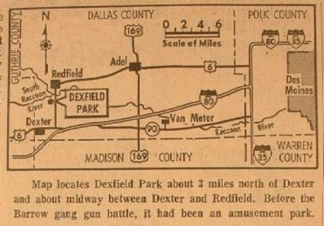
This map, which may have been included in a newspaper clipping, shows the location of Dexfield Park and several nearby cities. The amusement park closed around 1928. In 1933, it was the site of a shootout between Bonnie and Clyde's Barrow Gang and a group of local men. According to the map's caption, the map was created sometime after the Barrow Gang shootout. Content can be used with the following standards: 3rd grade SS 3.28 Cultural Contributions in a lesson on attractions and entertainment in Iowa during the early 1900s. Other objects from the Dexterfield Park can be found in relations. For any use other than instructional resources, please check with the organization that owns this item regarding copyright restrictions.
2018.009.015 [Map]
Legal Status
Ownership of this resource is held by the Dexter Historical Museum and has been provided here for educational purposes only, specifically for use in the Iowa Museum Association's "Teaching Iowa History" project. It may not be downloaded, reproduced or distributed in any format without written permission from the Rights Holder. For information on U.S. and International copyright laws, consult an attorney.

