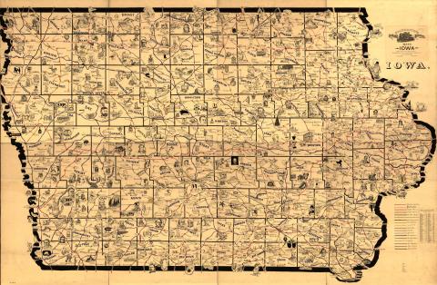
One of eight large-scale pictorial maps of midwestern states showing routes and post offices of the Railway Mail Service. Designed by Chicago railway mail clerk Frank H. Galbraith to help employees of the Railway Mail Service quickly locate counties and post offices. The maps were rented for practicing or prospective workers who numbered over 6,000 and traveled over a million miles a year on the rails sorting mail. A printed title cartouche accompanied by a list of counties for each of the states by McEwen Map Company of Chicago is pasted on the maps. Content can be used with the following standards: SS-Geo. 9-12.24 Iowans Influence Iowa Environment in a lesson on maps created for railway use. For any use other than instructional resources, please check with the organization that owns this item regarding copyright restrictions.
2018.056.001 [Map]
Legal Status
Ownership of this resource is held by the Library of Congress and has been provided here for educational purposes only, specifically for use in the Iowa Museum Association's "Teaching Iowa History" project. It may not be downloaded, reproduced or distributed in any format without written permission from the Rights Holder. For information on U.S. and International copyright laws, consult an attorney.

