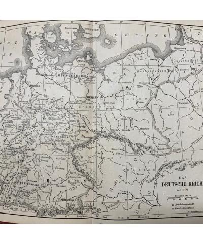
This is a map of the German Empire from inside a German language textbook, circa 1911. The map details the extent of the German Empire at that time, which stretched from Denmark in the north to Switzerland in the south and from Belgium in the west to the Russian Empire in the east. At this time, the German Empire consisted of the states of what were once Eastern Prussia, Western Prussia, Pomerania, Posen, Silesia, Brandenburg, Saxony, Holstein, Schleswig, Lauenburg, Hanover, Bavaria, Wartemburg, Hohenzollern, Alsace, Baden, Lorraine, Nassau, Hesse, and Westphalia. This large imperial entity was forged after the Franco-Prussian War of 1870, in which the militaristic Kingdom of Prussia consolidated power over the North German Federation and proclaimed Wilhelm I as the first German Emperor. The Empire was dissolved after the First World War and replaced by the Weimar Republic. This content can be used with the following resources: SS-WH.9-12.26: Iowans Influence World History This content can be used to educate students about the larger global context of the world around the era of World War I. It can be used to demonstrate how foreign subjects such as German literacy and cartography played into public education in states such as Iowa. For any use other than instructional resources, please check with the organization that owns this item for any copyright restrictions.
2021.003.009 [Map]
Legal Status
Copyright to this resource is held by the Davenport School Museum and has been provided here for educational purposes only, specifically for use in the Iowa Museum Association's "Teaching Iowa History" project. It may not be downloaded, reproduced or distributed in any format without written permission from the Rights Holder. For more information on U.S. and International copyright laws, consult an attorney.

